Starved Rock
Fort St. Louis, 1682. The siege legend, 1769.
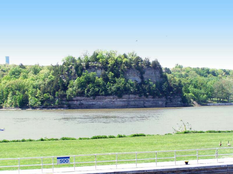
A 125-foot sandstone bluff carved out by Wisconsonian glacial meltwater fifteen thousand years ago. Louis Jolliet and Father Jacques Marquette were the first Europeans to see it in 1673. In the winter of 1683, Henri Tonti finished Fort St. Louis on top — a French anchor for the fur trade with the Illinois Confederation, ordered by his commander René-Robert Cavelier, sieur de La Salle. By 1720 the fort was gone. The legend that gave the rock its name dates from around 1769: after Ottawa Chief Pontiac was assassinated by an Illinois warrior in Cahokia, the Ottawa and their Potawatomi allies cornered a band of Illinois on top of the rock and besieged them until they starved. Eleven escaped during a thunderstorm, climbing down to canoes their enemies had left at the river.
Daniel Hitt bought the parcel from the federal government in 1835 for eighty-five dollars as compensation for his Army service. He sold it in 1890 to Ferdinand Walther for fifteen thousand. Walther built the original lodge, a natural pool, and a dance hall. Illinois bought it in 1911 as the state's second state park. The Civilian Conservation Corps built the current lodge and trails in the 1930s. Two million visitors a year now.